
Mountaineering Guide
Best Technical Mountains Above 6000m in Himachal Pradesh, India
Explore nine challenging mountains above 6,000 metres in Himachal Pradesh, including Deo Tibba, Papsura, Mount Ramjak, Menthosa, Reo Purgyil, Manirang and Mount Gya, with their elevations, locations, climbing challenges and the experience they need.
Himachal Pradesh is home to some of the most spectacular and demanding mountains in the Indian Himalayas. From the glaciated slopes of the Pir Panjal Range to the remote valleys of Kinnaur, Lahaul and Spiti, the state offers an extraordinary range of mountaineering objectives above 6,000 metres.
For climbers looking beyond trekking peaks and seeking genuine alpine experiences, Himachal Pradesh offers mountains involving glacier travel, steep snow and ice slopes, exposed ridges, technical climbing, remote approaches and challenging high-altitude conditions.
Some of these mountains are well known among Himalayan mountaineers, while others remain relatively unexplored because of their remoteness, complex terrain and demanding expedition logistics.
In this guide, we explore nine notable mountains above 6,000 metres in Himachal Pradesh, covering their elevations, geographical locations, climbing characteristics, technical challenges and the experience required to approach them responsibly.
Whether you are an experienced mountaineer planning your next Himalayan objective or researching technical 6000-metre peaks in India, this guide will help you understand the mountaineering opportunities available in Himachal Pradesh. For a wider list that also covers Ladakh, read our Top 10 Technical 6000m Mountains in India.
Table of Contents
- Deo Tibba – 6,001m
- Papsura – 6,451m
- Mount Ramjak – 6,318m
- Menthosa – 6,443m
- CB-13 – 6,164m / 6,264m
- CB-14 – 6,078m
- Reo Purgyil – 6,816m
- Manirang – 6,593m
- Mount Gya – approximately 6,794–6,795m
- Why Choose Himachal Pradesh for Technical Mountaineering?
- Best Time to Climb 6000m Mountains in Himachal Pradesh
- Skills and Preparation Required
- Essential Mountaineering Equipment
- Plan Your Himalayan Expedition with White Expedition
- Frequently Asked Questions
1. Deo Tibba – 6,001m
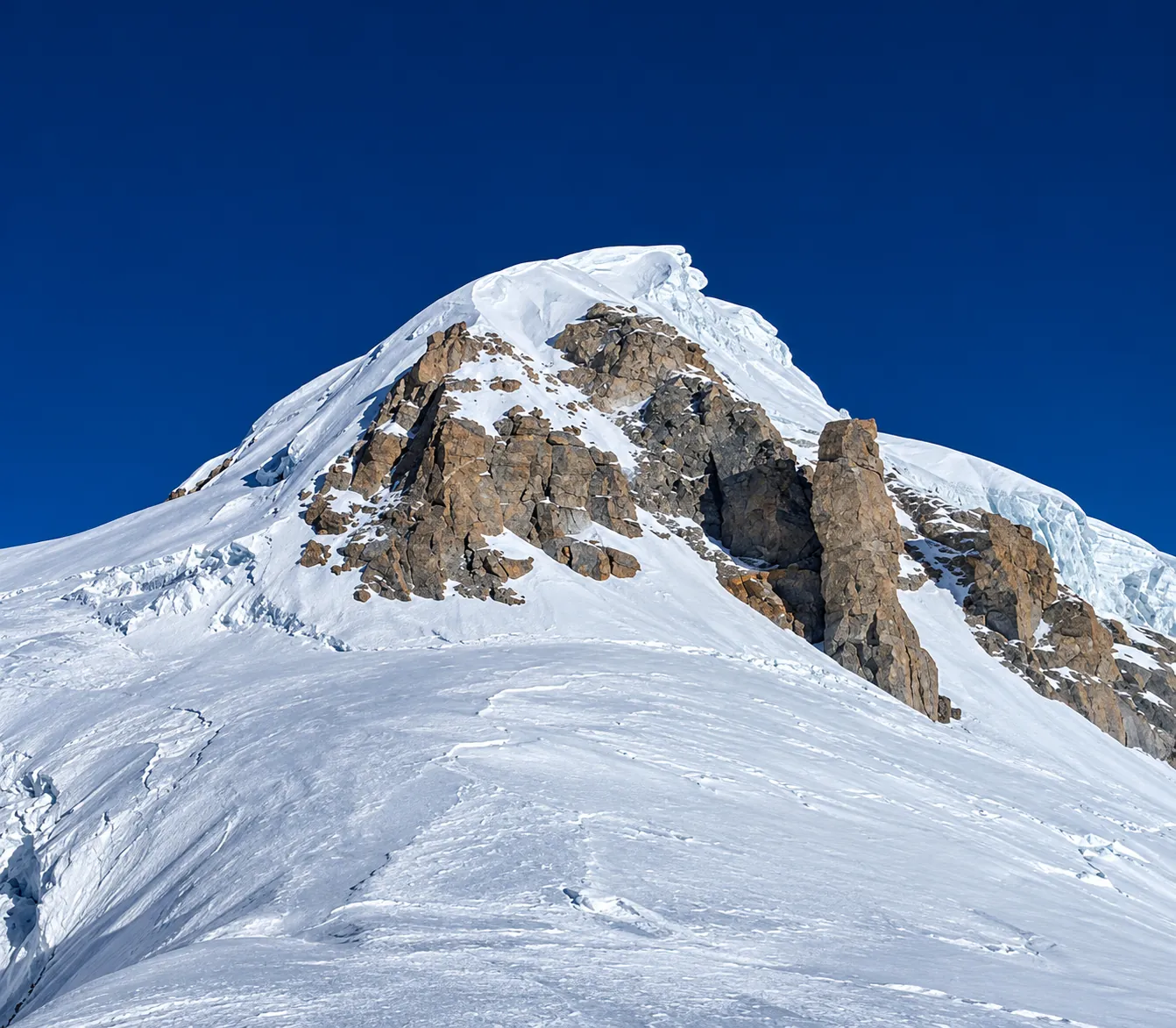
- Location: Pir Panjal Range, Kullu District
- Elevation: 6,001 metres
- Region: Manali, Himachal Pradesh
- Climbing character: Technical alpine mountaineering
Deo Tibba is one of the most recognised 6000-metre mountaineering objectives in Himachal Pradesh. Located in the Pir Panjal Range above the Kullu Valley, it offers a demanding combination of glacier travel, snow slopes, high-altitude camping and technical climbing.
The approach takes climbers through beautiful alpine landscapes before the terrain becomes increasingly demanding. The route generally passes through forests, meadows, moraines and glacial terrain before reaching the higher camps.
The upper mountain requires careful movement on snow and ice. Depending on the selected route and prevailing conditions, climbers may encounter crevasses, steep snow slopes and exposed sections requiring ropes, crampons and ice axes.
What makes Deo Tibba challenging?
- Glacier travel and crevasse navigation.
- Steep snow slopes and changing snow conditions.
- High-altitude camps and load carries.
- Technical movement using crampons, ice axes and rope systems.
- A demanding summit push in cold and exposed conditions.
Technical difficulty and climbing experience
Deo Tibba can be a valuable technical progression objective for mountaineers who already have experience in high-altitude trekking and basic snow skills. Climbers should understand crampon movement, ice axe techniques, rope management and glacier safety before attempting the mountain.
It should not be treated as an ordinary trekking peak.
Who should attempt it? Climbers with good physical fitness, prior high-altitude experience and appropriate mountaineering skills.
Explore: Deo Tibba Expedition with White Expedition
2. Papsura – 6,451m
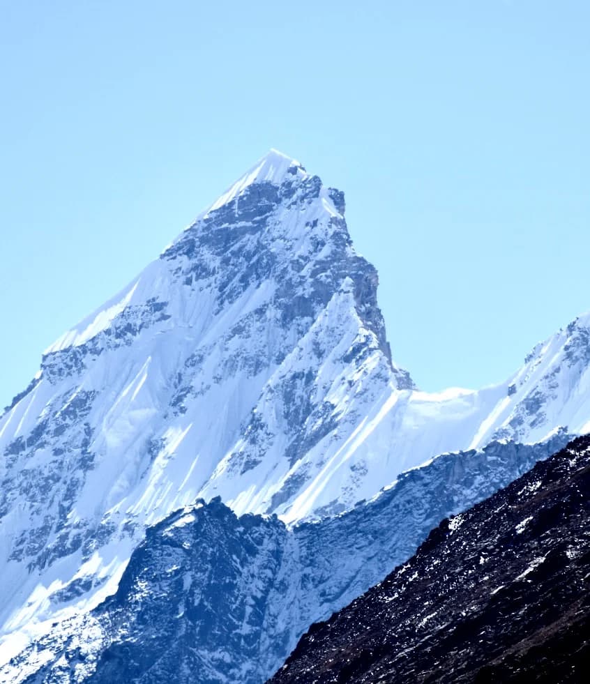
- Location: Pir Panjal Range, Kullu–Lahaul region
- Elevation: 6,451 metres
- Region: Himachal Pradesh
- Climbing character: Serious alpine mountaineering
Papsura is one of the most striking high mountains in the Pir Panjal Range. Rising to approximately 6,451 metres, it is widely known among Himalayan mountaineers for its imposing appearance and demanding climbing terrain.
The mountain is often associated with Dharamsura, its neighbouring peak. Together, these mountains form one of the most recognisable high-altitude mountain landscapes in the region.
Papsura is not simply a matter of reaching a high elevation. The expedition involves remote mountain terrain, complex approach logistics and careful decisions about route conditions, weather and summit timing.
Depending on the chosen route and seasonal conditions, climbers may face steep snow and ice, glacier travel, exposed sections and difficult upper-mountain terrain.
What makes Papsura challenging?
- Remote approach and expedition logistics.
- Glacier travel and high-altitude movement.
- Steep snow and ice sections.
- Exposure and route-finding challenges.
- Unpredictable weather and demanding summit conditions.
Technical difficulty and climbing experience
Papsura is generally more appropriate for experienced mountaineers who have already developed confidence in technical alpine terrain. Previous experience on challenging 6000-metre peaks, glacier travel and steep snow or ice is highly valuable.
Who should attempt it? Experienced climbers with glacier-travel knowledge, strong snow and ice skills, and previous expedition experience.
Explore: Papsura Expedition with White Expedition
3. Mount Ramjak – 6,318m
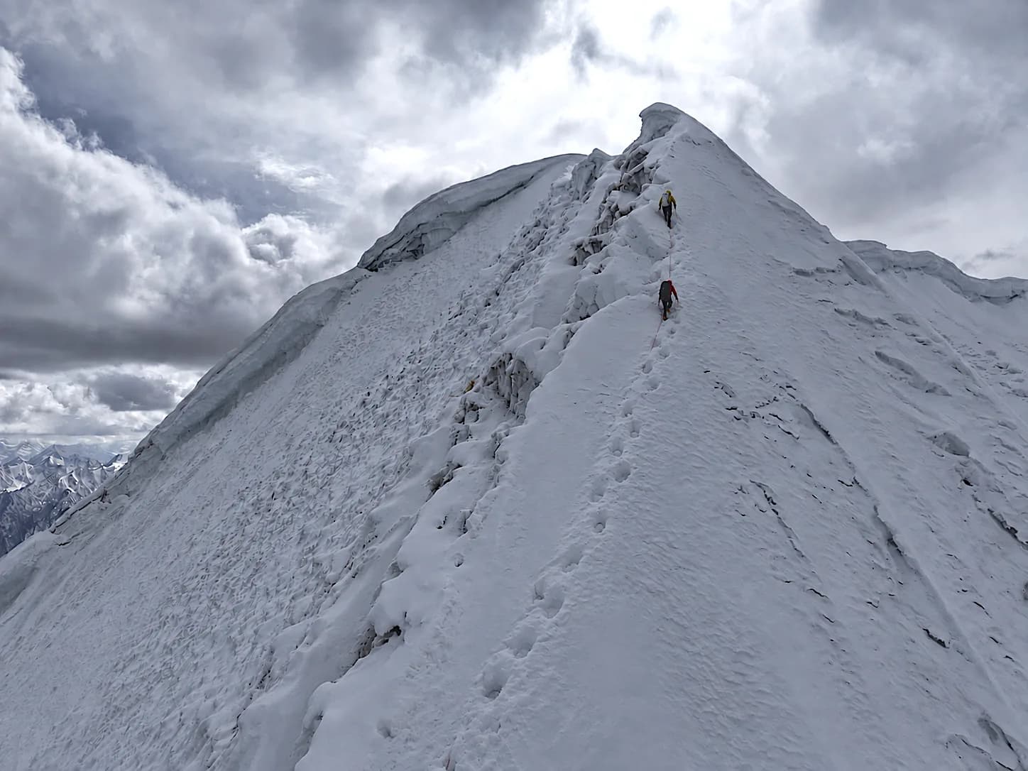
- Location: Shinkula region
- Elevation: 6,318 metres
- Region: Lahaul–Zanskar mountain region
- Climbing character: High-altitude alpine mountaineering
Mount Ramjak is a prominent mountain in the Shinkula region and an interesting objective for climbers exploring the lesser-known 6000-metre peaks of the Indian Himalayas.
Its remote setting and approach through the Shinkula region make it a different experience from the more frequently visited mountains around Manali.
The mountain offers a serious high-altitude environment where snow, ice, exposure and route-finding can play important roles. Its actual climbing character depends on the selected line and prevailing conditions.
One of the major considerations on Ramjak is the combination of altitude, approach logistics and the ability to make sound decisions as conditions change.
What makes Mount Ramjak challenging?
- Remote mountain access and expedition logistics.
- High-altitude snow and ice terrain.
- Route-finding in changing mountain conditions.
- Exposure on the upper mountain.
- The need for efficient movement and careful summit planning.
Technical difficulty and climbing experience
Ramjak is a worthwhile objective for climbers interested in exploring technical mountains beyond the most popular Himalayan routes. Its remote environment makes self-sufficiency, mountain judgment and proper expedition planning especially important.
Who should attempt it? Mountaineers with previous high-altitude experience, sound snow skills and the ability to operate safely in remote terrain.
White Expedition’s September 2026 Ramjak expedition included a fast ascent in the Shinkula region. The expedition offers an opportunity to share first-hand observations and original climbing photographs from the mountain.
Explore: Ramjak Peak Expedition Report – White Expedition and the Ramjak Peak Expedition
4. Menthosa – 6,443m
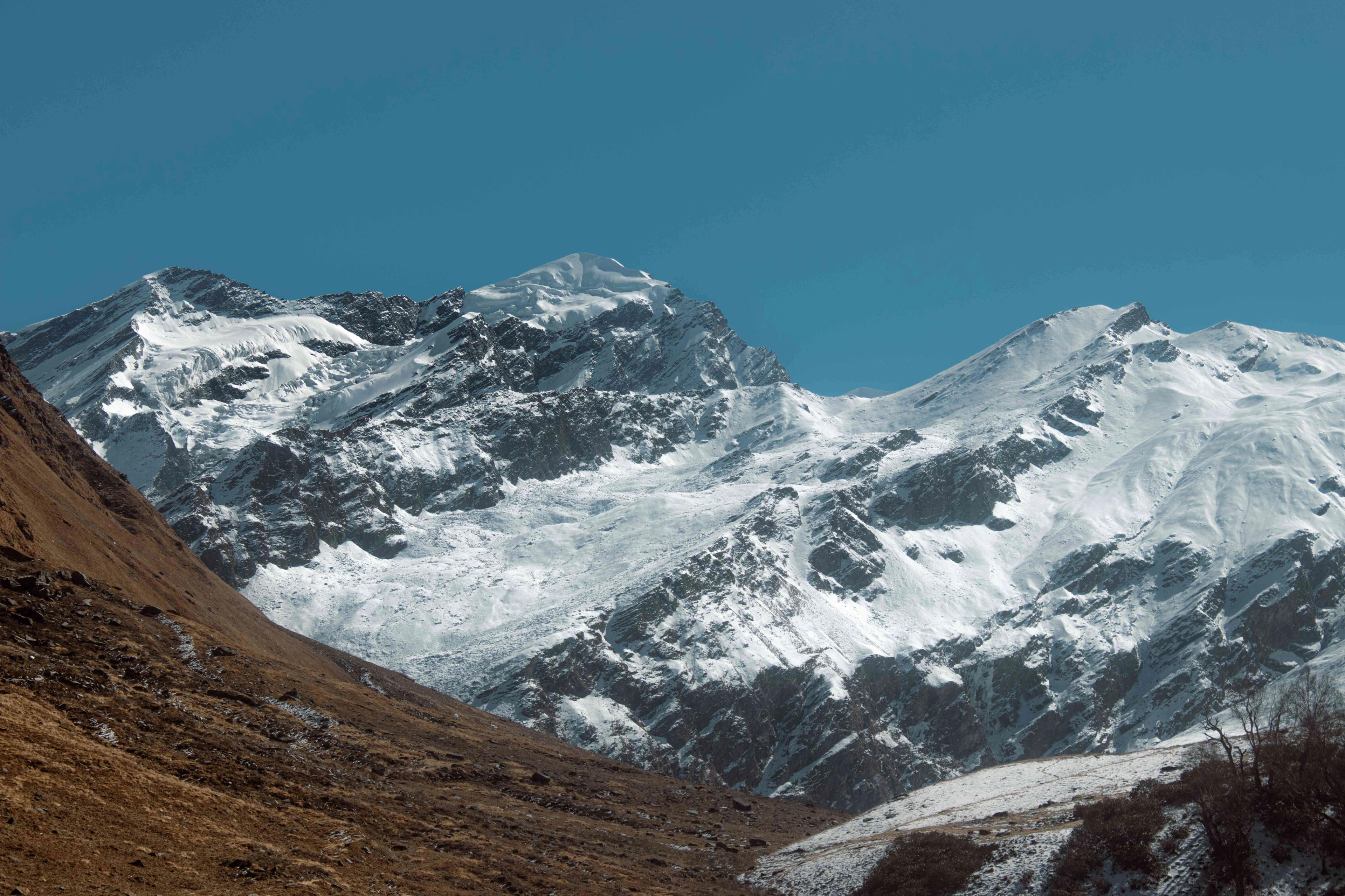
- Location: Miyar Valley, Lahaul
- Elevation: 6,443 metres
- Region: Lahaul, Himachal Pradesh
- Climbing character: Remote alpine mountaineering
Menthosa is one of the major high mountains of the Lahaul region. Standing at approximately 6,443 metres, it rises above the remote Miyar Valley, an area known for its dramatic mountain scenery, glaciers and long alpine approaches.
The Miyar Valley is a gateway to some of the most beautiful and less-explored mountain terrain in Himachal Pradesh. For mountaineers, the region offers a sense of remoteness that is increasingly difficult to find in more popular Himalayan destinations.
An expedition to Menthosa requires careful planning, particularly because of the approach, high-altitude camping and changing conditions of the upper mountain.
The technical nature of the climb depends on the route selected and the condition of snow, ice and glacier terrain during the expedition.
What makes Menthosa challenging?
- A long and remote approach through Miyar Valley.
- Glacier and snow travel.
- High-altitude acclimatisation and camping.
- Route-finding in complex mountain terrain.
- Weather exposure and summit-window planning.
Technical difficulty and climbing experience
Menthosa is an attractive objective for climbers looking for a serious expedition in a remote Himalayan valley. Climbers need to be prepared for sustained high-altitude movement and the technical requirements of their chosen route.
Who should attempt it? Experienced trekkers transitioning into mountaineering only with the required technical training, or climbers with previous high-altitude expedition experience.
5. CB-13 – 6,164m / 6,264m
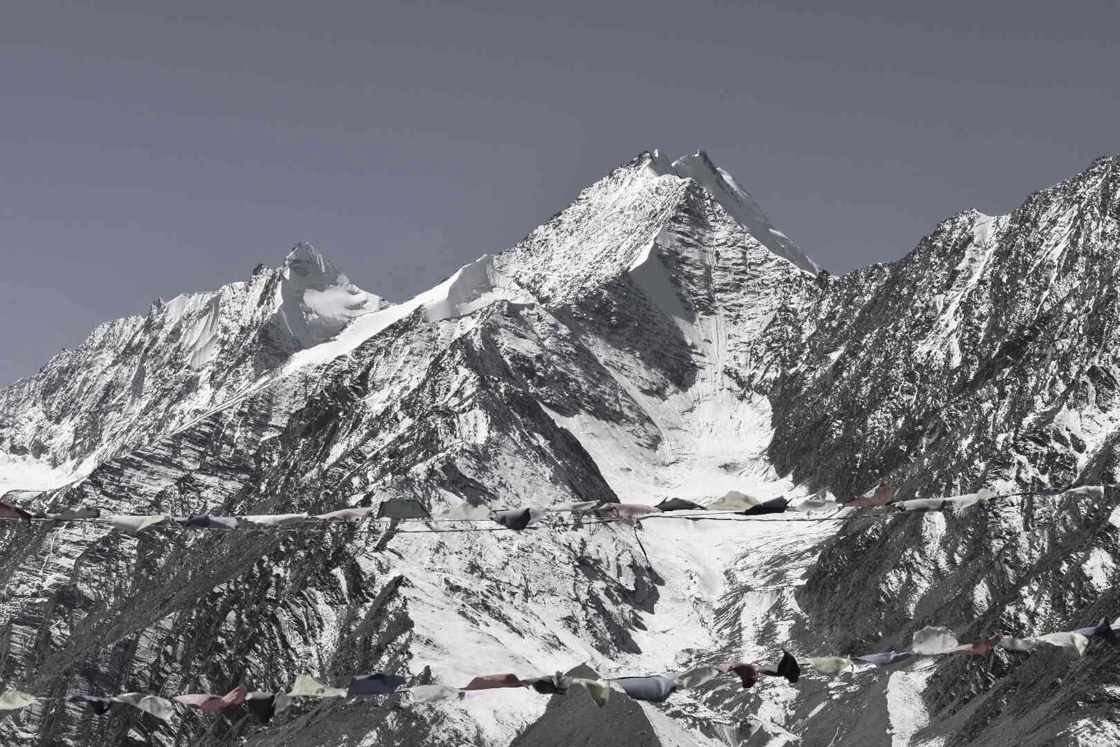
- Location: Chandrabhaga Range, Lahaul
- Elevation: 6,164m or 6,264m, depending on the official reference
- Region: Lahaul, Himachal Pradesh
- Climbing character: High-altitude alpine mountaineering
CB-13 is part of the Chandrabhaga mountain group in the Lahaul region. The CB peaks are known for their rugged terrain and the demanding conditions found around the high mountain valleys and glaciers.
One important detail about CB-13 is that official sources do not agree on its elevation.
The Ministry of Home Affairs list of mountain peaks opened for mountaineering expeditions by foreigners records CB-13 at 6,164 metres. However, the District Lahaul and Spiti administration’s peaks directory lists CB-13 at 6,264 metres.
Because of this difference, both elevations are mentioned rather than presenting one figure as universally accepted.
It is also important not to confuse CB-13 with CB-13A, which is listed separately at 6,240 metres.
What makes CB-13 challenging?
- High-altitude terrain in the Chandrabhaga region.
- Snow and glacier travel, depending on the route.
- Remote access and expedition logistics.
- Changing weather and snow conditions.
- The need for technical preparation and careful route assessment.
Technical difficulty and climbing experience
The CB mountain group offers interesting objectives for mountaineers who want to explore less-frequented parts of Lahaul. Route-specific information should be assessed before deciding whether a particular ascent is suitable.
Who should attempt it? Climbers with suitable high-altitude experience, technical training and a professionally assessed route plan.
6. CB-14 – 6,078m
- Location: Chandrabhaga Range, Lahaul
- Elevation: 6,078 metres
- Region: Lahaul, Himachal Pradesh
- Climbing character: High-altitude mountaineering
CB-14 is another notable mountain in the Chandrabhaga group. At 6,078 metres, it offers a different objective for climbers interested in exploring the high mountain terrain of Lahaul.
Compared with some of the more famous peaks in Himachal Pradesh, CB-14 receives less attention from general adventure travellers. Its appeal lies in its mountain setting, remote environment and opportunity to experience a less-commercialised part of the Indian Himalayas.
Although its elevation is lower than several other mountains in this guide, a 6000-metre peak should never be judged by altitude alone. Snow conditions, terrain, weather, access and route difficulty all influence the seriousness of an expedition.
What makes CB-14 challenging?
- High-altitude approach and camping.
- Snow and glacier conditions.
- Route selection and navigation.
- Limited infrastructure in remote terrain.
- Physical and mental demands of sustained high-altitude movement.
Technical difficulty and climbing experience
CB-14 is an interesting objective for climbers who want to explore the Chandrabhaga region and gain experience on lesser-known Himalayan mountains. The selected route should determine the technical equipment and experience required.
Who should attempt it? Fit and prepared mountaineers with suitable altitude experience and the technical skills required by the selected route.
7. Reo Purgyil – 6,816m
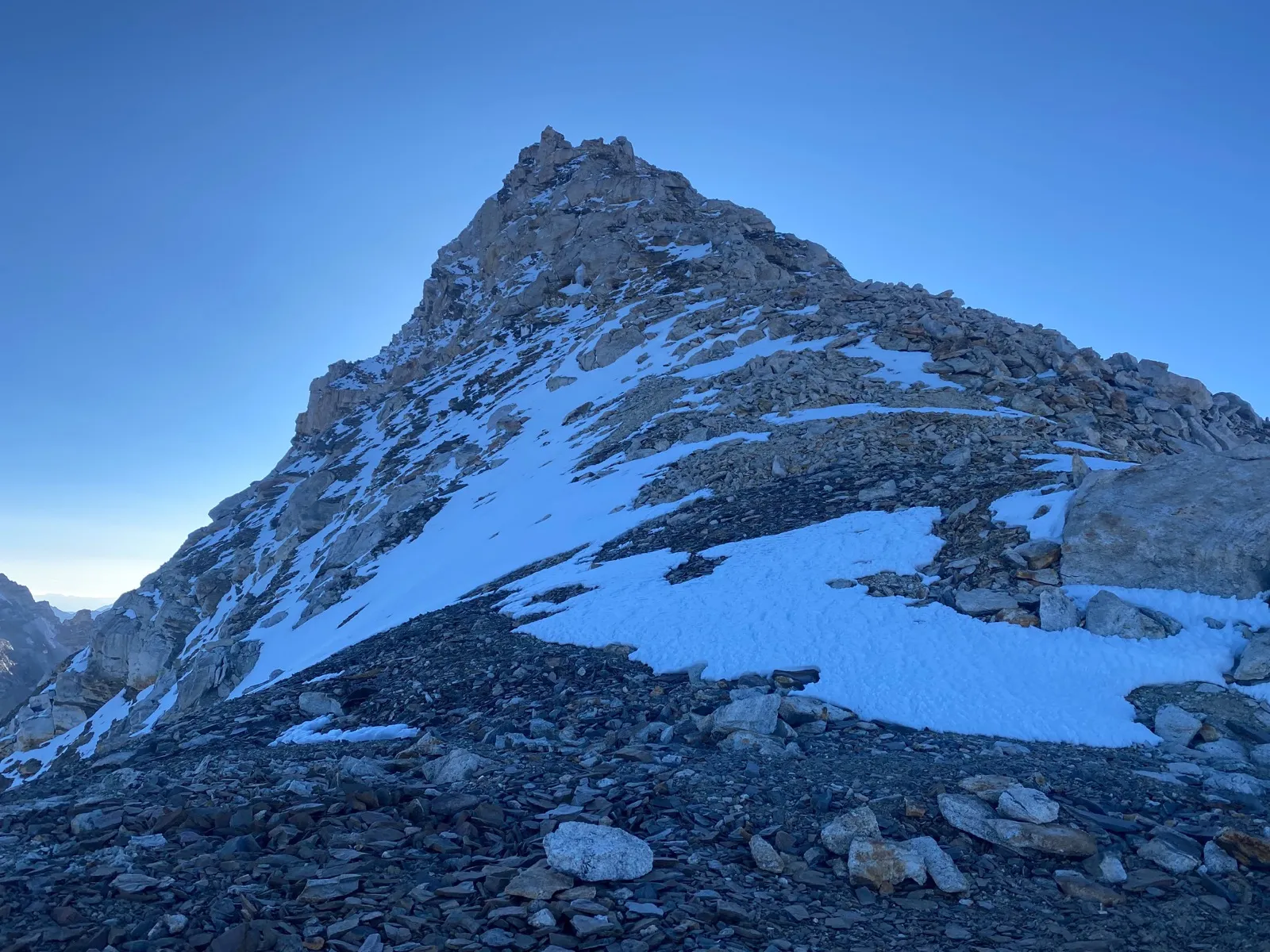
- Location: Kinnaur, Himachal Pradesh
- Elevation: 6,816 metres
- Region: Kinnaur
- Climbing character: Serious high-altitude alpine mountaineering
Reo Purgyil, at 6,816 metres, is recognised as the highest mountain in Himachal Pradesh. Located in the Kinnaur region near the Indo-Tibetan border, it is one of the most prominent and imposing mountains in the state.
The mountain rises above the high-altitude landscapes of Kinnaur, where dry valleys, rugged ridgelines and dramatic Himalayan terrain create a unique climbing environment.
Reo Purgyil is a serious mountaineering objective. Its altitude, remote location, weather exposure and upper-mountain conditions demand careful expedition planning and strong high-altitude judgment.
The mountain should not be confused with Leo Pargial. Reo Purgyil and Leo Pargial are separate summits in the broader region, with different recorded elevations. Reo Purgyil is listed at 6,816 metres, while Leo Pargial is commonly listed at approximately 6,791 metres.
What makes Reo Purgyil challenging?
- High altitude and demanding acclimatisation.
- Remote access and logistical planning.
- Snow, ice and exposed mountain terrain.
- Weather changes and limited summit windows.
- The need for strong route judgment and disciplined decision-making.
Technical difficulty and climbing experience
For experienced mountaineers, Reo Purgyil represents one of the most significant climbing objectives in Himachal Pradesh. Its elevation alone makes acclimatisation and expedition planning critical, while route conditions determine the technical skills needed.
Who should attempt it? Experienced high-altitude mountaineers with strong expedition skills, technical preparation and the ability to manage remote mountain conditions.
Explore: Reo Purgyil Expedition with White Expedition
8. Manirang – 6,593m

- Location: Kinnaur–Spiti region
- Elevation: 6,593 metres
- Region: Himachal Pradesh
- Climbing character: Technical high-altitude mountaineering
Mount Manirang is one of the major mountains of the Kinnaur–Spiti region. At 6,593 metres, it stands in a rugged landscape where the greener Himalayan valleys begin to transition into the drier terrain of the Trans-Himalaya.
The mountain is particularly interesting for climbers who want to experience a remote and demanding Himalayan expedition away from more crowded climbing regions.
Manirang requires careful planning around approach logistics, acclimatisation, route conditions and high-altitude movement. Its terrain and climbing demands vary with the chosen route and seasonal conditions.
What makes Manirang challenging?
- High-altitude approach and acclimatisation.
- Snow and ice movement.
- Remote terrain and expedition logistics.
- Route-finding and changing weather.
- Sustained physical effort at altitude.
Technical difficulty and climbing experience
Manirang is an excellent example of the diverse mountaineering opportunities available in Himachal Pradesh. Its location between Kinnaur and Spiti also gives the expedition a distinctive Trans-Himalayan character.
Climbers should have experience in high-altitude environments and be comfortable with the technical systems required by their selected route.
Who should attempt it? Climbers with previous high-altitude experience, good physical conditioning and appropriate technical skills.
Explore: Manirang Peak Expedition – White Expedition
9. Mount Gya – Approximately 6,794–6,795m

- Location: Lingti Valley, Spiti, on the Himachal Pradesh–Ladakh border
- Elevation: Approximately 6,794–6,795 metres
- Region: Spiti, Himachal Pradesh, bordering Changthang, Ladakh
- Climbing character: Remote high-altitude mountaineering
Mount Gya is one of the highest and most remarkable mountains in the Spiti region. Rising above the remote Lingti Valley to approximately 6,794–6,795 metres, its summit sits where Spiti meets the Changthang region of Ladakh, in the dramatic landscape of the high-altitude Himalaya.
Gya is particularly interesting because of its remote setting and the relatively limited access to the surrounding mountain terrain. It attracts attention from climbers interested in exploration rather than only following established and frequently used expedition routes.
The elevation is recorded slightly differently in different references. The District Lahaul and Spiti peaks directory lists Gya at 6,794 metres, while other government material records it at approximately 6,795 metres.
An expedition in this region requires careful planning for access, acclimatisation, weather and route conditions. The remote environment also makes logistics and emergency planning especially important.
What makes Mount Gya challenging?
- Remote location in the Lingti Valley.
- High-altitude approach and acclimatisation.
- Complex mountain terrain.
- Weather exposure and route-finding.
- Limited infrastructure and demanding expedition logistics.
Technical difficulty and climbing experience
Gya is a compelling objective for experienced mountaineers interested in the less-explored mountains of Spiti. Its altitude and remote location make sound expedition leadership and appropriate technical preparation essential.
Who should attempt it? Experienced climbers with strong high-altitude judgment, appropriate technical training and a well-planned expedition team.
Explore: Mt Gya Expedition – White Expedition, which approaches the mountain from the Changthang side in Ladakh.
10. Why Choose Himachal Pradesh for Technical Mountaineering?
Himachal Pradesh offers some of the most varied mountaineering terrain in the Indian Himalayas. The state includes parts of the Pir Panjal, Greater Himalayan and Trans-Himalayan mountain systems, with peaks spread across Kullu, Lahaul, Spiti and Kinnaur.
Here are five reasons why the region attracts mountaineers from India and around the world.
1. A wide range of 6000-metre objectives
From Deo Tibba and Papsura to Reo Purgyil and Manirang, Himachal offers mountains with different elevations, approaches and climbing characteristics.
2. Technical alpine terrain
Several mountains involve glacier travel, snow and ice climbing, exposed ridges, rope systems and high-altitude camps. These conditions provide valuable experience for climbers progressing towards more demanding Himalayan objectives.
3. Remote and less-frequented regions
Areas such as Miyar Valley, Lingti Valley and parts of the Kinnaur–Spiti region offer remote mountain environments where expedition planning and self-sufficiency are essential.
4. Diverse mountain landscapes
The climbing environment changes significantly across the state. Climbers can experience lush alpine valleys, glaciated mountain basins, rocky ridges and dry Trans-Himalayan landscapes.
5. Opportunities for mountaineering progression
Himachal offers objectives for climbers at different stages of their mountaineering journey. However, choosing a mountain should always depend on actual experience and technical ability, not simply its elevation.
11. Best Time to Climb 6000m Mountains in Himachal Pradesh
The climbing season depends on the mountain, route, snow conditions and weather pattern. There is no single best month that applies to every 6000-metre peak in Himachal Pradesh.
Broadly, two climbing periods are commonly considered.
Pre-monsoon season: May to June
The pre-monsoon period can offer suitable conditions for several Himalayan objectives. Snow conditions, temperature and weather windows vary depending on the mountain and the progress of the season.
Potential advantages include:
- Longer daylight hours as the season progresses.
- Potentially suitable snow conditions on selected routes.
- Opportunities for spring and early-summer expeditions.
Post-monsoon season: September to October
The post-monsoon period is another important climbing window for several mountains in Himachal Pradesh.
Potential advantages include:
- More settled weather periods after the monsoon.
- Clearer mountain views on suitable days.
- Opportunities for autumn climbing objectives.
What about winter climbing?
Winter expeditions are a separate and more specialised undertaking. Extremely low temperatures, stronger winds, deep snow, shorter daylight hours and difficult access can increase the risks considerably.
The correct season must be selected for each mountain after assessing its route, weather history, snowpack and current conditions.
12. Skills and Preparation Required for a Technical 6000m Mountain
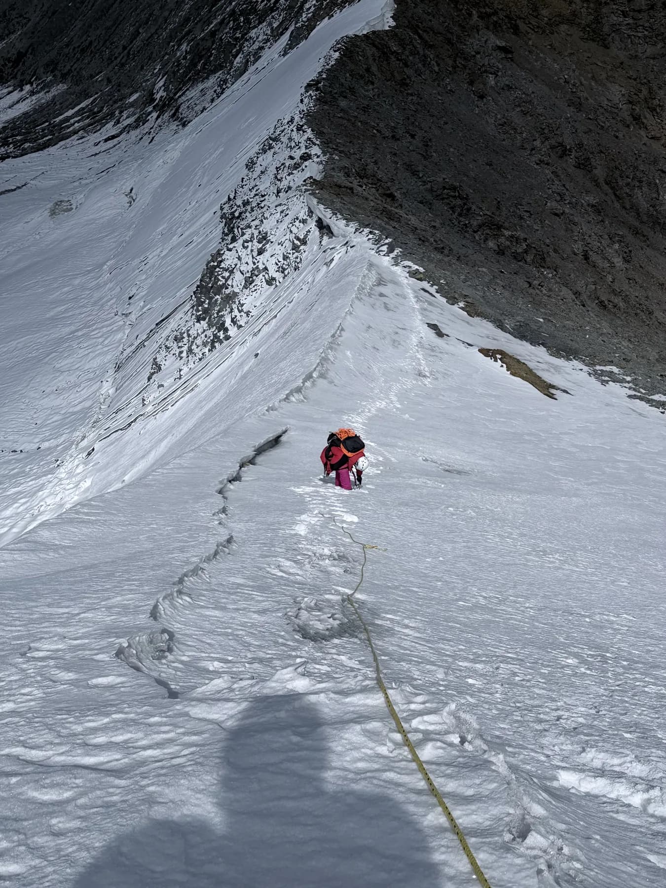
Climbing a 6000-metre mountain is not just about physical fitness. It requires a combination of endurance, technical ability, mountain judgment and the capacity to make safe decisions in difficult conditions.
Before attempting a technical 6000-metre peak, climbers should work on the following areas.
Physical fitness
A strong aerobic base is essential. Training should include long hikes, uphill walking, running, cycling and endurance exercises.
Climbers should also develop leg strength, core stability and the ability to carry a backpack over sustained uphill terrain.
Acclimatisation
The body needs time to adapt to lower oxygen availability at altitude. A properly designed acclimatisation schedule is essential.
Climbers should understand the symptoms of altitude-related illness and follow appropriate ascent and descent protocols.
Snow and ice skills
Depending on the mountain and route, climbers may need experience with:
- Crampon techniques.
- Ice axe use.
- Self-arrest.
- Rope handling and basic knots.
- Fixed-rope ascent and descent.
- Glacier travel and crevasse-rescue techniques.
Navigation and mountain judgment
Mountaineers should understand route-finding, weather assessment, turnaround decisions and the importance of adjusting plans when conditions change.
Previous mountaineering experience
For a technical 6000-metre expedition, previous high-altitude experience is strongly recommended. Climbers should choose an objective that matches their actual skills and experience.
13. Essential Mountaineering Equipment for a 6000m Expedition
The equipment required depends on the mountain, route, season and expedition style. A typical technical mountaineering equipment list may include:
Personal clothing
- High-quality down jacket.
- Down trousers.
- Thermal base layers.
- Fleece or mid-layer.
- Waterproof and windproof outer shell.
- Insulated gloves and liner gloves.
- Warm mountaineering socks.
- Balaclava and warm cap.
- Mountaineering sunglasses.
- Sunscreen and lip protection.
Technical climbing equipment
- Mountaineering boots suitable for the route.
- Crampons.
- Ice axe.
- Climbing harness.
- Helmet.
- Locking carabiners.
- Ascender or jumar.
- Belay and rappel equipment, as required.
- Trekking poles for the approach.
Personal essentials
- Headlamp with spare batteries.
- Water bottles or insulated flask.
- Summit backpack.
- Sleeping bag suitable for expected temperatures.
- Personal first-aid items.
- High-altitude personal essentials as advised by the expedition leader.
Safety and group equipment
Depending on the route, the expedition may also require:
- Fixed ropes.
- Snow and ice anchors.
- Crevasse-rescue equipment.
- Group medical kit.
- Emergency communication equipment.
- Appropriate rescue and evacuation arrangements.
Equipment should be selected and checked by experienced expedition leaders. Carrying technical gear without knowing how to use it does not make a climber safe.
14. Plan Your Himalayan Expedition with White Expedition
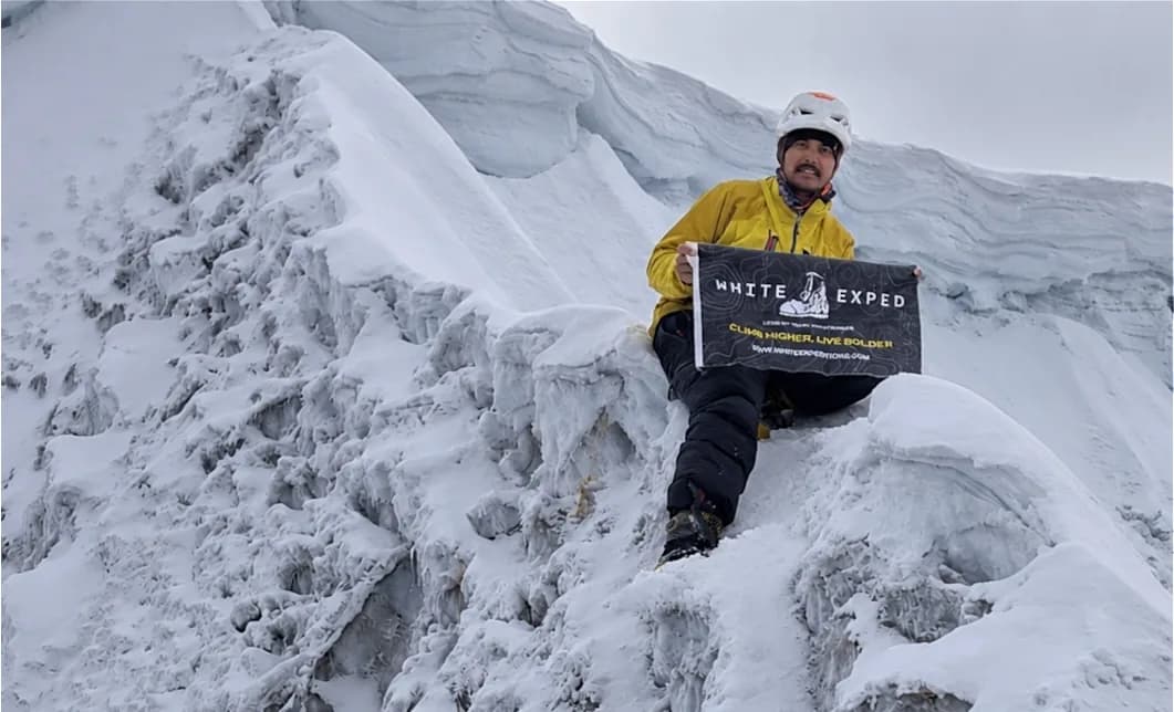
White Expedition is a mountaineering-focused expedition company operating across the Indian Himalayas, including Himachal Pradesh and Ladakh.
Founded by Himalayan mountaineer Rahul Thakur, widely known as Ricky Mountaineer, White Expedition focuses on technical mountaineering, high-altitude expeditions and exploratory mountain objectives.
Our approach is built around small expedition groups, professional mountain leadership, careful planning and a strong focus on safety.
With extensive experience across Himalayan mountain regions, our team works with climbers who want to explore the mountains through professionally organised expeditions, from technical 6000-metre objectives to more demanding high-altitude mountains.
What makes White Expedition different?
- Small expedition groups with attention to individual climbers.
- Experienced mountain leadership.
- Route planning and acclimatisation support.
- Technical equipment and climbing systems appropriate to the objective.
- Attention to weather, mountain conditions and summit decisions.
- Expedition logistics and on-ground coordination.
- A mountaineering-focused approach rather than general adventure tourism.
Mountaineering experience of the founder
Rahul Thakur, also known as Ricky Mountaineer, has climbed 49 Himalayan peaks above 6,000 metres, according to his October 2026 Project 50 update. His experience includes solo ascents, fast ascents, technical climbing and exploratory mountain objectives.
His personal goal is to complete the 50 Peaks Above 6,000 Metres project, a journey focused on exploring and climbing 50 Himalayan mountains above 6,000 metres.
This first-hand experience helps shape White Expedition’s approach to mountain planning, route assessment and responsible expedition leadership.
Every mountain is different, and the right expedition should be selected according to a climber’s experience, fitness, technical ability and available time.
If you are planning a 6000-metre mountaineering expedition in Himachal Pradesh, explore our current objectives and speak with our team before choosing your mountain.
Explore more
- White Expedition
- Himalayan Mountaineering Expeditions
- Explore 6000m Himalayan Peaks
- About Rahul Thakur – Ricky Mountaineer
15. Frequently Asked Questions
1. Which is the highest mountain in Himachal Pradesh?
Reo Purgyil, at approximately 6,816 metres, is recognised as the highest mountain in Himachal Pradesh. It is located in the Kinnaur region near the Indo-Tibetan border.
2. Which are some of the most technical mountains above 6000m in Himachal Pradesh?
Deo Tibba, Papsura, Reo Purgyil, Manirang and Menthosa are among the notable high-altitude mountaineering objectives in the state. Their actual difficulty depends on the route, conditions and season.
3. Is Deo Tibba suitable for beginners?
Deo Tibba is a technical 6000-metre mountain and should not be treated as a beginner trek. Climbers should have suitable fitness, high-altitude experience and the technical skills required for the route.
4. What is the best time to climb 6000m mountains in Himachal Pradesh?
May to June and September to October are broad climbing periods for several objectives. However, the best season differs from mountain to mountain and must be confirmed through route-specific planning.
5. Do I need previous mountaineering experience to climb a 6000m peak?
For technical 6000-metre mountains, previous high-altitude and mountaineering experience is strongly recommended. The required experience depends on the specific mountain and route.
6. Is Reo Purgyil the same as Leo Pargial?
No. Reo Purgyil and Leo Pargial are separate summits in the broader Kinnaur region. Reo Purgyil is recorded at 6,816 metres, while Leo Pargial is commonly listed at approximately 6,791 metres.
7. Why are CB-13 elevations listed differently?
The Ministry of Home Affairs list records CB-13 at 6,164 metres, while the District Lahaul and Spiti peaks directory records it at 6,264 metres. CB-13A is listed separately at 6,240 metres.
8. Is Mount Gya located in Spiti?
Yes. Mount Gya rises above the Lingti Valley in Spiti, and its summit lies on the border with the Changthang region of Ladakh. Official references list its elevation at approximately 6,794–6,795 metres.
9. What technical equipment is required for a 6000m expedition?
Depending on the route, climbers may need mountaineering boots, crampons, an ice axe, harness, helmet, ropes, carabiners, an ascender, suitable high-altitude clothing and other safety equipment.
10. Can I climb these mountains with a guided expedition?
Yes, guided expeditions are available for selected Himalayan objectives. Choose a professional operator with suitable mountain leadership, route knowledge, safety procedures and an expedition plan appropriate to the mountain.
11. Are all 6000m mountains in Himachal Pradesh technical?
No. A mountain’s elevation alone does not determine its technical difficulty. Some routes may involve relatively straightforward snow climbing, while others require advanced glacier travel, steep ice climbing, mixed terrain and complex rope systems.
About the Author

Rahul Thakur – Ricky Mountaineer, Founder, White Expedition
Rahul Thakur, widely known as Ricky Mountaineer, is a Himalayan mountaineer and the founder of White Expedition. Born in Shimla, Himachal Pradesh, he has spent years exploring and climbing mountains across the Indian Himalayas.
With 49 Himalayan peaks above 6,000 metres climbed, according to his October 2026 update, his mountaineering journey includes technical ascents, solo climbs, fast ascents, alpine-style expeditions and exploratory objectives.
He is currently working towards completing his personal 50 Peaks Above 6,000 Metres project, focused on climbing 50 Himalayan peaks above 6,000 metres.
Through White Expedition, Rahul aims to share his experience of Himalayan mountaineering with climbers from India and around the world while promoting responsible climbing, mountain knowledge and safety-focused expeditions.
References and Further Reading
The following official and mountaineering resources can help readers verify mountain elevations, locations and general mountaineering information.
- District Lahaul and Spiti – Official Peaks Directory: hplahaulspiti.nic.in
- Himachal Tourism – Mountaineering and Rock Climbing: himachaltourism.gov.in
- Ministry of Home Affairs – Gazette of India, 2025: List of Mountain Peaks Opened for Mountaineering Expeditions: egazette.gov.in
- Himachal Pradesh Town and Country Planning – Regional Plan: tcp.hp.gov.in
- The Himalayan Club – Himalayan Journal: himalayanclub.org/hj
Elevation figures in this article are based on published government and mountaineering references. Differences between published records are identified where relevant. Route conditions and climbing difficulty should always be checked with current, reliable expedition information.